В чем неправ Трилон Маск: деревья не спасут планету от глобального потепления — Naked Science
среда, 20 ноября 2019 г.
пятница, 18 октября 2019 г.
Лазерное сканирование большой арены Кишиневского Цирка
В рамках капитального ремонта большой арены Кишиневского Цирка было выполнено наземное лазерное сканирование наружной и внутренней части здания арены.
Работы были выполнены сканером LEICA C10 компании TOPEXPERT SRL бригадой в составе: Евгений Морков, Андрей Яковлев, Григорий Бешлиу-Басок. Обработка в ПО LEICA CYCLONE была выполнена мною.
Плотность сканирования - HiRes (5cm).
Количество станций - 19, продолжительность полевых работ - 2 полных рабочих дня.
Количество станций - 19, продолжительность полевых работ - 2 полных рабочих дня.
Размер полевых данный - 11.5 Гб.
воскресенье, 13 октября 2019 г.
Soluție WEB GIS pentru administrarea documentației de urbanism
În anul 2014 grupa de inițiativă a elaborat conceptul și soluție complexă WEB GIS pentru administrarea documentației de urbanism în cadrul secției de arhitectură a autorității publice locale pe baza platformei GISCUIT.COM (Geoportal.md lansat în 2010 este bazat pe acesta platforma)
Soluție pilot înclude elaborarea și administrarea următoarelor documente:
Această soluție a fost propusă pentru implementare Direcției Arhitectură, Urbanism și Relațiilor Funciare a Consiliului Municipal Chișinău și era respinsă sub un pretext artificial.
Spre regret soluție descrisă are două ”neajunsuri” critice:
Soluție pilot înclude elaborarea și administrarea următoarelor documente:
- Certificat de urbanism
- Autorizare de construire
- Plan trasare a rețelelor
- Recepție finală
Această soluție a fost propusă pentru implementare Direcției Arhitectură, Urbanism și Relațiilor Funciare a Consiliului Municipal Chișinău și era respinsă sub un pretext artificial.
Spre regret soluție descrisă are două ”neajunsuri” critice:
- prețul rezonabil
- lucru se efetuează prin browser
- amplasarea în cloud
- utilizarea componentelor open-source, înclusiv și bazei de date PostGIS
- transparența la limiă a proceselor
- urmărirea documentului la orice etapa
- colaborarea prin internet pentru avizarea documentelor
- publicarea automată a documentelor aprobate
- urmărirea automată a modificaărilor
- blocarea modificărilor în documente aprobate
Cum se vede acestea ”neajunsuri” limitează critic posibilitatea de implementare a soluției respective.
Вэб ГИС решение для управления градостроительной документацией
В 2014 году инициативной группой была разработана концепция и комплексное вэб гис решение для управления градостроительной документацией отдела архитектуры публичной местной власти на базе платформы Giscuit.com (на данной платформе с 2010 года работает Geoportal.md)
Пилотное решение включало в себя выдачу и учет следующих документов:
Данное решение было предложено Управлению Архитектуры и Земельных Отношений Муниципального Совета Кишинева и было отвергнуто под надуманными (по моему мнению) поводами.
Пилотное решение включало в себя выдачу и учет следующих документов:
- градостроительный сертификат
- разрешение на строительство
- АПЗ трассы инженерной сети
- приемка по окончании работ
Данное решение было предложено Управлению Архитектуры и Земельных Отношений Муниципального Совета Кишинева и было отвергнуто под надуманными (по моему мнению) поводами.
К сожалению оно имеет два серьёзных "недостатка"
- невысокая стоимость
- работа выполняется через браузер
- размещение в облаке
- использование ПО с открытым кодом, в том числе базы данных PostGIS
- предельная прозрачность процессов
- отслеживание документа на всех этапах
- взаимодействие через интернет для согласования документов
- автоматическая публикация утвержденных документов
- автоматическое отслеживание изменений
- блокирование изменений в утвержденных документах
Как видно эти "недостатки" серьезно ограничивают вероятность внедрения данного решения
среда, 2 октября 2019 г.
Brusselization
Brusselization - Wikipedia
... By the middle 20th century there was a tacit alliance between urban development entrepreneurs and local government, with a modernist agenda and with their sights set firmly on large-scale development projects. The citizens of Brussels were largely left out of the process.
... By the middle 20th century there was a tacit alliance between urban development entrepreneurs and local government, with a modernist agenda and with their sights set firmly on large-scale development projects. The citizens of Brussels were largely left out of the process.
суббота, 21 сентября 2019 г.
воскресенье, 8 сентября 2019 г.
среда, 4 сентября 2019 г.
Conversion and direct reading of MapInfo data in ArcGIS
TAB Reader provides features for importing and preserving symbology and rendering properties, attributes and information about coordinate system allowing to easily perform data migration from MapInfo to ArcGIS.
The option of viewing and direct reading of TAB files and MapInfo workspaces in ArcCatalog, as well as exporting feature classes to TAB files provide tight integration of MapInfo data into ArcGIS environment.
воскресенье, 18 августа 2019 г.
Dual-Frequency GNSS – An important location feature your phone is probably missing
It’s not something you often think about, but location services are probably one of the most-used features on your smartphone. A multitude of apps—from Pokémon GO to Snapchat—rely on your location to personalize your experience and provide you with more features. Of course, this goes beyond just casual app usage. Accurate location is everything when you’re driving around a big city looking for a parking space. Unfortunately, when it comes to the vast majority of modern devices, accurate location is not something you can be 100% sure of.
Single vs. Dual-Frequency GNSS
Your phone determines its position by listening to radio signals from satellites in outer space, or Global Satellite Navigation Systems (GNSS). The norm in today’s smartphone market is single-frequency GNSS. In essence, what this means is that your smartphone tracks a single radio signal from each satellite. However, single-frequency GNSS is prone to multipath errors. Multipath errors occur when a signal bounces off of large objects such as buildings, resulting in multiple “echo” signals reaching the device. This can result in inaccuracies of around 5 meters. In real-world terms, what this means is that in big cities, your mapping app may not be able to tell exactly which street you’re on. While better quality antennae can be more accurate, it’s common for your phone to report incorrect locations in built-up areas due to multipath errors.
So how does dual-frequency GNSS rectify this issue? The short answer is two is better than one. Instead of relying on just one signal to determine your location, devices track more than one signal from each satellite, each on a different radio frequency. For Americans with the GPS systems, the frequencies are called L1 and L5. For Europeans with the Galileo satellites, the frequencies are called E1 and E5a. While most current devices only use the L1/E1 frequency, dual-frequency-enabled devices make use of both. The L5/E5a signals are more advanced, and thus less prone to multipath errors. They can be used to refine position accuracy to as low as 30cm (versus the 5m mentioned earlier).
вторник, 13 августа 2019 г.
FieldGenius for Android™
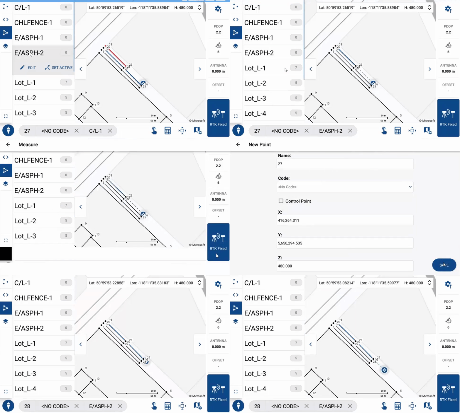
New technology opens new opportunities to develop better tools for use in the survey industry. FieldGenius for Android™ extends MicroSurvey’s mission to provide a brand neutral solution with drivers to support most common hardware available in the market today.
воскресенье, 4 августа 2019 г.
Poster Presentation Design
A poster session is the presentation of research information by an individual or members of a research team. Poster presentations or sessions have become a major format of communication at academic conferences or meetings. Check with the sponsoring conference, association, or agency for guidelines and deadlines for submission.
пятница, 2 августа 2019 г.
пятница, 19 июля 2019 г.
"Нулевой километр" современной европейской геодезии обнаружен в Браславском районе
Точка, с которой начала построение геодезическая сеть Российской империи и в целом общеевропейская, обнаружена на холме вблизи агрогородка Дрисвяты в Браславском районе, передает корреспондент БЕЛТА.
Дрисвятское основание является первым базисным измерением, одной из опорных сторон при создании первых триангуляционных построений в западной части Российской империи.
Читать полностью: https://belta.by/regions/view/nulevoj-kilometr-sovremennoj-evropejskoj-geodezii-obnaruzhen-v-braslavskom-rajone-355363-2019/
пятница, 26 апреля 2019 г.
A new version of Sputnik GIS presents new tools, optimized performance, usability, and new integration capabilities - GISuser.com
A new version of Sputnik GIS presents new tools, optimized performance, usability, and new integration capabilities - GISuser.com: RECRUITERS Post your GeoJob Ad Today Sputnik GIS is a professional drone surveying software for engineers, surveyors, and urban planners. Visualize and analyze multidimensional spatial data with no limits on data size, create surveys and get insights from your drone data in height performance GIS solution. Optimization and integration capabilities: Sputnik GIS 1.4 has a …
четверг, 21 марта 2019 г.
Geospatial is not GIS
https://www.forbes.com/sites/forbestechcouncil/2019/03/21/geospatial-is-not-gis/#713d193960ec
четверг, 24 января 2019 г.
Skycatch High Precision Package
Skycatch High Precision Package
Maps & Point Clouds in 30 Minutes
High-speed processing delivers your data in localized coordinates, with the fastest turnaround time on the market. No uploadingtime on the market. No uploading
GPS Base Station Included
Serves as a dedicated RTK base station and processes your drone data in the field, even without internet connection.
Precision
Get the most out of your drone program by flying daily without wasting time maintaining or marking GCPs.
четверг, 10 января 2019 г.
Ортофото с дронов
Коллега Анатолий Головко поделился результатами работы по созданию ортофото с использование дронов DJI.
Кроме представленный ниже обзорных изображений, оригиналы доступны по ссылке
В леовском районе
В Кишиневе
Кроме представленный ниже обзорных изображений, оригиналы доступны по ссылке
В леовском районе
В Кишиневе
среда, 9 января 2019 г.
NEXT GENERATION MAPPING – SAVING TIME IN CONSTRUCTION SURVEYING WITH DRONES
STRABAG Deploys the Phantom 4 RTK for Construction Surveying to Create Precise 3D Models
Подписаться на:
Комментарии (Atom)


