среда, 13 декабря 2017 г.


пятница, 22 сентября 2017 г.
пятница, 18 августа 2017 г.
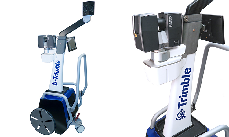
Trimble TX8 3D laser scanner with an extendable tripod
Reaching New Heights
Ian Harding, a surveyor at Taylors in Melbourne, was engaged to provide survey information about several roof structures at a prestigious private school in an affluent Melbourne suburb.
The Trimble TX8 3D laser scanner, along with an extendable tripod, was offered as the best solution to obtain the survey information due to limited roof access. This method did not require working at heights, nor did it require the surveyor to stand at risk on the external roof space. The data captured provided the client with an accurate model of the roof structure in the safest possible manner.
www.taylorsds.com.au
www.taylorsds.com.au

понедельник, 26 июня 2017 г.
Геопортал почв Молдавии
ГП "Проектный Институт по Землеустройству" запустил геопортал почв Молдовы. Лично я узнал об этом совсем недавно. Радует что есть информация и в открытом доступе. Всем кто приложил усилия для это события мои поздравления и уважение.


воскресенье, 4 июня 2017 г.
Galileo boosts GNSS corrections services
Trimble’s RTX-based correction services now support the Galileo constellation. As a true five-constellation technology that uses GPS, GLONASS, BeiDou, QZSS and now Galileo satellites, Trimble RTX delivers improved real-time positioning performance to its users worldwide.
http://gpsworld.com/galileo-boosts-gnss-corrections-services/

http://gpsworld.com/galileo-boosts-gnss-corrections-services/
суббота, 20 мая 2017 г.
пятница, 12 мая 2017 г.

четверг, 4 мая 2017 г.
TIMMS INDOOR MAPPING
TIMMS provides both LiDAR and spherical video, enabling the creation of accurate, real-life representations (maps, models) of interior spaces and all of its contents; every object in the interior space - including desks, chairs, stairs, and doors - appear in the plan. The maps are geo-located, meaning that the real world positions of each area of the building and its contents are known.
пятница, 10 марта 2017 г.
Sensor role reversal: How lidar can replace GNSS for navigation
Airborne lidar/INS/GNSS: Algorithm Uses Fuzzy Controlled Scale Invariant Feature Transform

Opening Figure. Comparison between SR and DEM data from the same area.
Sensor role reversal: Lidar with its superior performance can replace GNSS in the integration solution by providing fixes for the drifting inertial measurement unit (IMU). Tests show its potential for terrain-referenced navigation due to its high accuracy, resolution, update rate and anti-jamming abilities. A novel algorithm uses scanning lidar ranging data and a reference database to calculate the navigation solution of the platform and then further fuse with the inertial navigation system (INS) output data.

Подписаться на:
Сообщения (Atom)