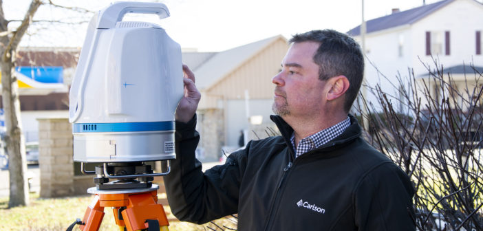
The Carlson Scan2K is Carlson’s latest lidar solution for the creation of accurate 3D point clouds with ranges up to 2,000 meters under the right conditions. The Scan2K was designed with a total station workflow in mind simplifying the field data collection and georeferencing procedures. The Scan2K was designed with the surveying and mining environment in mind and is at home in the field with its weather-proof IP64 housing, sunlight-visible touch screen interface with intuitive menu-driven operations for quickly collecting and georeferencing point cloud data. The Scan2K features an integrated high-resolution camera, inclinometers, a compass, and an L1 GNSS receiver. The Scan2K can be deployed in various environments and orientations, including mobile and kinematic operations.